Locations
Locations let you label real-world places (rooms, services, collections) and tie them into the routing network so users can find and highlight them in the Viewer/Navigator.
Concept

A Location is made of two parts:
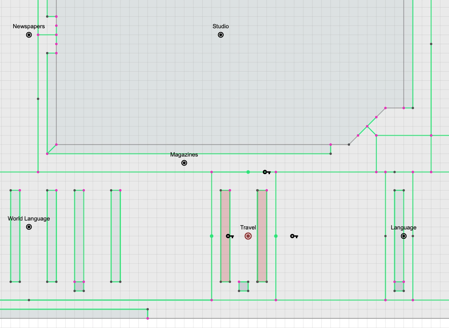
- Access Points — a list of entry nodes (shown with a key icon in the viewport). These are the points where a person can enter/exit the location (e.g., doors to a conference room).
- Surfaces — one or more polygons that visually highlight the area for that location (e.g., the footprint of a room or multiple shelf regions).
Routing uses access points. Highlighting uses surfaces.
Create a Location
A) Convert an orphan point (quick add)
- Important: Make sure you're on the routes layer (location points can only be created on the routes layer)
- Click the Add Point button (+) in the toolbar to start drawing
- Click once on the map where you want the location marker to live
- Press Esc to finish early. You'll end with a "line" that has only one point.
- MapBoot treats that orphan point as a Location point and converts it automatically.
- You can move this point later; the location label/icon renders at this point.
Routes Layer Required
Location points can only be created on the routes layer. If you create an orphan point on the graphics layer, it will be automatically deleted. This is because locations are part of the routing system.
Drawing vs Selection
The Point/Line/Polygon buttons in the toolbar are for selection mode. To draw and create location markers, use the Add Point button (+).
Note
Location markers are movable: drag the point to adjust where the label/icon appears.
Access Points (required for routing)
Access points define how the router can reach a location from the walking network.
- In the location properties, use Pick to select one or more access points directly from the viewport.
- Typical access points are door center points or connectors that physically touch a corridor/path.
- When multiple access points are defined, the router automatically chooses the closest one to the user’s start point.
Rules
- An access point must be connected to the walking network (lines).
If there’s no literal line connection from the route network to the access point, no path can be returned.
Surfaces (visual highlight)
Surfaces are polygons that highlight the footprint of your location. Use them when: - The location spans multiple areas (e.g., “History aisle” scattered on a floor). - You want the Viewer to shade/outline the target area when the location is searched.
You can manage a list of polygons for a single location. All assigned surfaces will highlight when the location is queried.
Move or Delete a Location
- Move: drag the location’s base point to a new place; the label/icon follows.
- Delete: a location can be deleted by deleting the correspoding base point from the viewport.
Routing Behavior
- Routing uses access points only (not the polygon surfaces).
- If multiple access points exist, the closest reachable one from the starting position is used.
- If no access point connects to the walking network, the router cannot reach the location and returns no path.
Warning
If a location can’t be found by the router, verify that at least one access point is connected to the path network with actual lines. Visual proximity is not enough—there must be a node/segment intersection.
User Interface

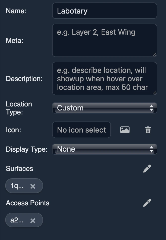
- Name — Location title .
- Meta Data — Stores general metadata about the location, used for search and discoverability.
- Description — descriptive text that will show up on location card info when hovered/focused.
- Location Type — Specifies the location type, custom will let you define a custom icon, non custom location has predefined icons.
- Display type — Sets the display type when on viewer, example do you want the location to show title/ label or none by default.
- Surfaces — A list of polygon surfaces that represent the teritory of the location .
- Access points — Represent a list of access points to the location on the routes layer, example location is room A access points are the entrances of room A on the routes network.
Best Practices
- Place the location marker where the label should appear (near the center or the main entrance).
- Define all valid access points (entrances on routes layer). More options give better routes.
- Keep surfaces accurate but lightweight—avoid overly complex polygons.
- Ensure network connectivity: access points must be connected to the routes network.
- For departmental/aisle-style locations, add multiple surfaces so all relevant areas highlight.
Troubleshooting
-
No route found Ensure at least one access point is connected to the routes network on the routes layer.
-
Wrong entrance chosen Add all entrances as access points on the routes layer—the router will pick the closest/most appropriate. Remove any you don't want used.
-
Highlight missing
Verify one or more surfaces are assigned to the location and they’re visible on the current floor/layer.
If you need help modeling locations or diagnosing routing gaps, email contact@mapboot.com.